We are a group of scientists going together on a cruise to support the NSF funded Salinity Intrusions Project using the R/V Neil Armstrong. Our journey will begin from the Woods Hole Oceanographic Institution to the shelf break at about 100 m depth near the Pioneer Array region around 71W, 40N.
The Salinity Intrusions project is funded by NSF. The project is seeking to identify and map Salinity Maximum Intrusions extending from upper continental slope onto continental shelf. We will take turbulence measurements to identify the spatial and temporal patterns of mixing around the intrusions. One of the objectives is to determine their cross-shelf extent and how rapidly they evolve in time. The project is utilizing 4 AUV’s simultaneously as well as turbulence measurements. Surface signatures of Warm Core Rings and shelf-slope frontal meanders from satellites will guide us continuously during the two week period.
We have some cool instruments on board including multiple REMUS-100 and a Long Range AUV for mapping the intruding features in 3-D. Additionally the VMP will measure vertical microstructure and quantify turbulence parameters within the intrusion. We will describe them as we go along.
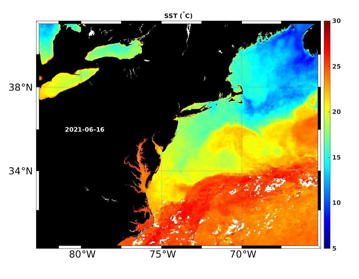
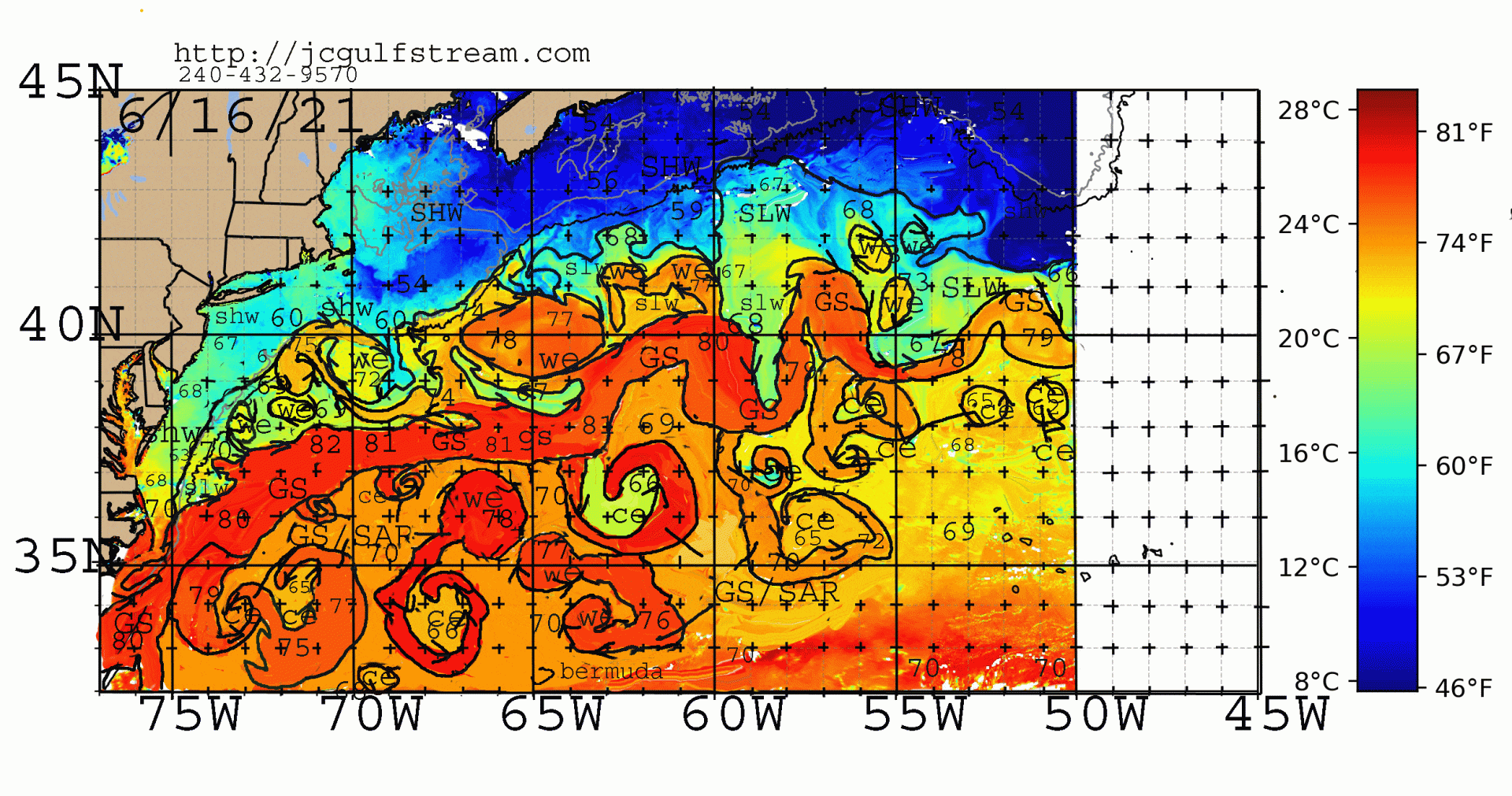
We will be looking for salty and warm intrusions of Gulf Stream and Warm Ring waters across the shelf break into the cool and fresh shelf waters of offshore of New England. Satellite data for temperature (SST), height (SSH tracks), Chlorophyll (SSC) will be used in addition to nearby Argo floats in the adjacent slope waters to develop the larger perspective of the increasing warming in the slope sea and its impact on the shelf ecosystem. A particular aspect of that ecosystem is the possibility of lining the intrusions with Squid. More on that later.
For today, June 16, 2016 — We received two satellite-derived products. The 7-day composite from MARACOOS site (Thanks to Adrienne) and the GS-Ring Analysis from Jenifer Clark (Thanks, Jenifer). We are ready for some interesting science ahead!


